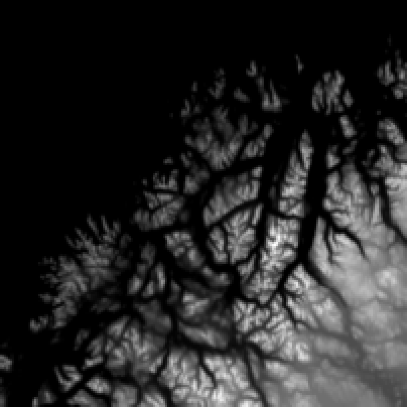
A topographic map of Tromsoe, used as input for the Monte Carlo model. The total area is 201 x 201 km² and the pixel size is 1 x 1 km². Bright pixels indicate high altitude, dark pixels correspond to low altitude.